No Photo
Property Record
2343 Dawsonville Hwy, Gainesville, GA 30506
NEARBY LISTINGS FOR SALE OR LEASE
Property Detail
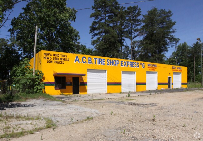
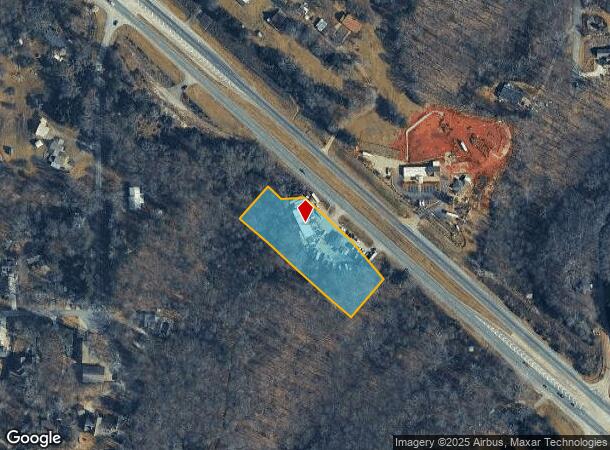
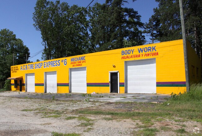
2343 Dawsonville Hwy
10-00085-00-049
2343 DAWSONVILLE HIGHWAY
Autorepair
Hall
X
Georgia
13139C0175G
1.91 AC
2025
Gainesville/Hall Cnty
2025
Atlanta
000306
Gainesville, GA
3,200 SF
DEMOGRAPHICS near 2343 Dawsonville Hwy
1 Mile
3 Mile
5 Mile
2024 Total Population
1,588
19,260
68,292
2029 Population
1,786
21,368
76,082
Pop Growth 2024-2029
+ 12.47%
+ 10.94%
+ 11.41%
Average Age
44
41
39
2024 Total Households
610
7,538
25,000
HH Growth 2024-2029
+ 12.46%
+ 10.86%
+ 11.43%
Median Household Inc
$81,955
$69,749
$63,530
Avg Household Size
2.60
2.50
2.60
2024 Avg HH Vehicles
2.00
2.00
2.00
Median Home Value
$468,811
$376,966
$330,364
Median Year Built
1993
1991
1989
Nearby Places
Map Layers
Map Styles
 Street
 Aerial
- Restaurants
- Banks
- Shops
- Fitness
- Groceries
PUBLIC TRANSPORTATION
COMMUTER RAIL
Gainesville Amtrak Station (Crescent - Amtrak)
DRIVE
WALK
Distance
Gainesville Amtrak Station (Crescent - Amtrak)
9 min
6.0 mi
Freight Ports
Georgia Ports - Savannah
DRIVE
WALK
Distance
Georgia Ports - Savannah
324 min
256.3 mi
SALE & LEASE HISTORY
LISTING DATE
SALE/LEASE

Jun 29, 2017
For Sale
Nearby Properties
Address
Land Use
TOTAL SIZE
Lot Size
Zoning
Address
Land Use
TOTAL SIZE
Lot Size
Zoning
66,720 SF
27.49 AC
PUD
Address
Land Use
TOTAL SIZE
Lot Size
Zoning
19,875 SF
19.76 AC
R-B
Address
Land Use
TOTAL SIZE
Lot Size
Zoning
163,951 SF
19.10 AC
AR-1
Address
Land Use
TOTAL SIZE
Lot Size
Zoning
56,780 SF
16.78 AC
PUD
Address
Land Use
TOTAL SIZE
Lot Size
Zoning
54,720 SF
32.52 AC
R-II
Address
Land Use
TOTAL SIZE
Lot Size
Zoning
123,944 SF
13.21 AC
G-B
Address
Land Use
TOTAL SIZE
Lot Size
Zoning
113,288 SF
46.89 AC
AR-1
Address
Land Use
TOTAL SIZE
Lot Size
Zoning
1,628 SF
10.41 AC
PUD
Address
Land Use
TOTAL SIZE
Lot Size
Zoning
37,632 SF
8.52 AC
R-II
Address
Land Use
TOTAL SIZE
Lot Size
Zoning
93,869 SF
10.40 AC
PUD
Address
Land Use
TOTAL SIZE
Lot Size
Zoning
118,564 SF
2.97 AC
PUD
Address
Land Use
TOTAL SIZE
Lot Size
Zoning
99,093 SF
10.94 AC
R-B
Address
Land Use
TOTAL SIZE
Lot Size
Zoning
26,480 SF
10.08 AC
O-I
Address
Land Use
TOTAL SIZE
Lot Size
Zoning
62,894 SF
6.02 AC
G-B
Address
Land Use
TOTAL SIZE
Lot Size
Zoning
1,610 SF
6.69 AC
R-II
Address
Land Use
TOTAL SIZE
Lot Size
Zoning
20,850 SF
8.76 AC
PUD
Address
Land Use
TOTAL SIZE
Lot Size
Zoning
163.30 AC
R-I-A
Address
Land Use
TOTAL SIZE
Lot Size
Zoning
1,457 SF
9.71 AC
R-II
Address
Land Use
TOTAL SIZE
Lot Size
Zoning
53.42 AC
R-I-A
Address
Land Use
TOTAL SIZE
Lot Size
Zoning
27,750 SF
9.56 AC
R-II
Address
Land Use
TOTAL SIZE
Lot Size
Zoning
17,500 SF
7.66 AC
G-B
Address
Land Use
TOTAL SIZE
Lot Size
Zoning
109,621 SF
14.84 AC
R-B
Address
Land Use
TOTAL SIZE
Lot Size
Zoning
6,256 SF
4.45 AC
G-B
Address
Land Use
TOTAL SIZE
Lot Size
Zoning
6,816 SF
8.34 AC
R-II
Address
Land Use
TOTAL SIZE
Lot Size
Zoning
60,426 SF
7.13 AC
PUD
Address
Land Use
TOTAL SIZE
Lot Size
Zoning
55,904 SF
2.01 AC
G-B
Address
Land Use
TOTAL SIZE
Lot Size
Zoning
5,508 SF
H-B
Address
Land Use
TOTAL SIZE
Lot Size
Zoning
200.48 AC
PRD
Address
Land Use
TOTAL SIZE
Lot Size
Zoning
29,845 SF
9.39 AC
AR-1
Address
Land Use
TOTAL SIZE
Lot Size
Zoning
52,712 SF
4.60 AC
G-B
The World's #1 Commercial Real Estate Marketplace
Connect with us
© 2025 CoStar Group
The information above has been obtained from sources believed reliable. While we do not doubt its accuracy we have not verified it and make no guarantee, warranty or representation about it. It is your responsibility to independently confirm its accuracy and completeness. Any projections, opinions, assumptions, or estimates used are for example only and do not represent the current or future performance of the property. The value of this transaction to you depends on tax and other factors which should be evaluated by your tax, financial, and legal advisors. You and your advisors should conduct a careful, independent investigation of the property to determine to your satisfaction the suitability of the property for your needs.